
Chris Suchan just posted this forecast:
Ohhh boy! Strong cold front is trending.
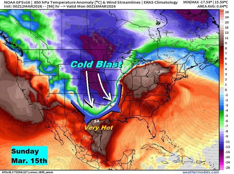
Get ready for a major swing in our area Sunday to Monday based on latest data trends I've looked over. I've noted a shift west in the very cold air mass diving into the country and this puts Texas a little more into the crosshairs of its punch.
As seen here, we'll challenge a record hot day Sunday then see the cold front arrive around 4PM – 7PM with northerly wind gusts of 35 – 45+mph as front pushes through.
This would push us into the upper 30s – low 40s in and around San Antonio Monday morning (wind chill upper 20s – low 30s). Hill Country flirting with a light freeze Monday morning.
Monday highs stays in 50s to near 60 followed by a cold night into Tuesday morning. This would give us patchy frost 30s Tuesday morning with colder areas seeing a light freeze. If we have clouds Monday night, that would help us. If air mass shifts east, that would help us too…. we're 5 – 6 days out.
by isurus79
Comments are closed.